Google Maps Navigation (Beta) is an internet-connected turn-by-turn, GPS navigation system with voice guidance on Samsung Galaxy Note 2.
Note: Traffic data is not real-time and directions may be wrong, dangerous, prohibited, or involve ferries.
Note: To receive better GPS signals, avoid using your device in the following conditions:
- in a vehicle with tinted windows
- around high-voltage or electromagnetic fields
- in poor weather
- in a tunnel or underground passage
- inside a building or between buildings
- From the Home screen, tap Apps > Navigation icon.
- Read the on-screen disclaimer regarding the current release status of the Navigation app and tap Accept.
How to enable GPS Location on Samsung Galaxy Note 2
- Press Home button > Menu key and then tap Settings > Location services.
- Tap Use wireless networks allows apps to use data from sources such as Wi-Fi and mobile networks to provide a better approximation of your current location.
- Tap Location and Google search to allow Google to use your location data to improve your search results and other services.
Navigation options on Samsung Galaxy Note 2
- From the Home screen, tap Apps > Navigation icon. The navigation application can be configured from the main screen.
- If prompted, read the on-screen disclaimer and tap Accept.
- Choose from the following on-screen options:
- Driving/Walking : tap to configure the method of travel. Selection of Walking would negate the need to track traffic jams and obstructions.
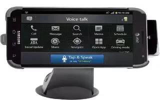
- Speak destination: allows you to use the voice recognition feature to search for matching locations in your area.
- Type destination: allows you to manually enter a destination address (via the on-screen keypad).
- Go Home: allows you to return to a designated Home location.
- When prompted initially to setup a home address, enter the location into the Enter an address field and tap Save.
- Map: enables the on-screen real-time map functionality.
Navigation Map options on Samsung Galaxy Note 2
Once on the map screen, you can access the following features:
- Search by voice: Speak your destination instead of typing.
- Destination: returns you to the previous Navigation options screen.
- Layers: allows you to switch map views:
- Traffic view: (available only in selected areas) Real-time traffic conditions are displayed over roads as color-coded lines. Each color represents how fast the traffic is moving.
- Satellite: Maps uses the same satellite data as Google Earth. Satellite images are not real-time. Google Earth acquires the best imagery available, most of which is approximately one to three years old.
- Parking: displays parking information relative to your current location.
- Gas stations: displays gas station location relative to your current location.
- ATMs & banks: displays ATM and Bank locations relative to your current location.
- Restaurants: displays restaurant and eatery locations relative to your current location.
- While on the map screen, press Menu key to access additional options:
- Set destination: returns you to the navigation options screen where you can access a destination by either Speaking, Typing, or selecting from a
- Contacts entry or Starred Place.
- Search: manually search for a destination address, place, name of business, or even a type of business.
- Layers: allows you to switch map views. See previous description.
- Settings: provides access to both Power settings (Screen dimming) and Information (Terms, privacy & notices).
- Exit navigation: terminates the application.
- Help: requires selecting either the Internet or Popup Browser option to review online help.
